 To dive deeper into leveraging drones in construction, make sure to check out my full article “How Drones are used for Construction Monitoring“
 Click into my article “How to start your Drone Mapping Business” to learn more about getting started working in this industry.
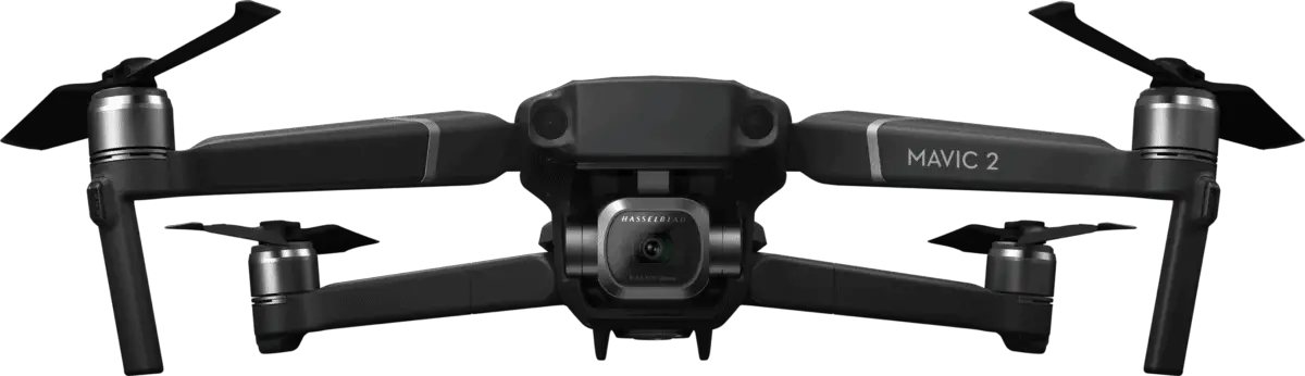 The DJI Mavic 2 Pro platform is an ideal entry-point drone if portability is a priority.
- DJI Mavic 2 Pro – 20 megapixel resolution with a 1-inch Image Sensor, ISO range from 100 – 12,800, and 100Mbps Video Bit Rate, OcuSync 2.4 to 5.8 GHz auto-switching
- Obstacle Detection – the Mavic 2 Pro series offers Omnidirectional Obstacle Sensing on all sides, top and bottom, and proven to ensure avoiding obstacles and preventing any crash incidents.
- Availability – at the time of this writing, the Mavic 2 Pro is discontinued, but it is important to note that this drone can be purchased at extremely affordable prices via online marketplaces such as eBay and others.
* For current comparable model details and pricing, please click HERE.
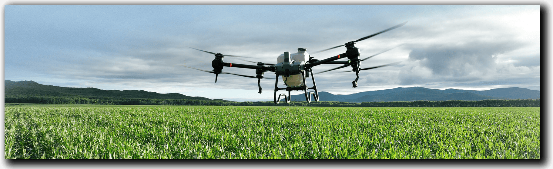
Agriculture and Crop Monitoring have emerged as another of the top drone services this year! I’m excited to get into the remarkable role drones play in this vital industry.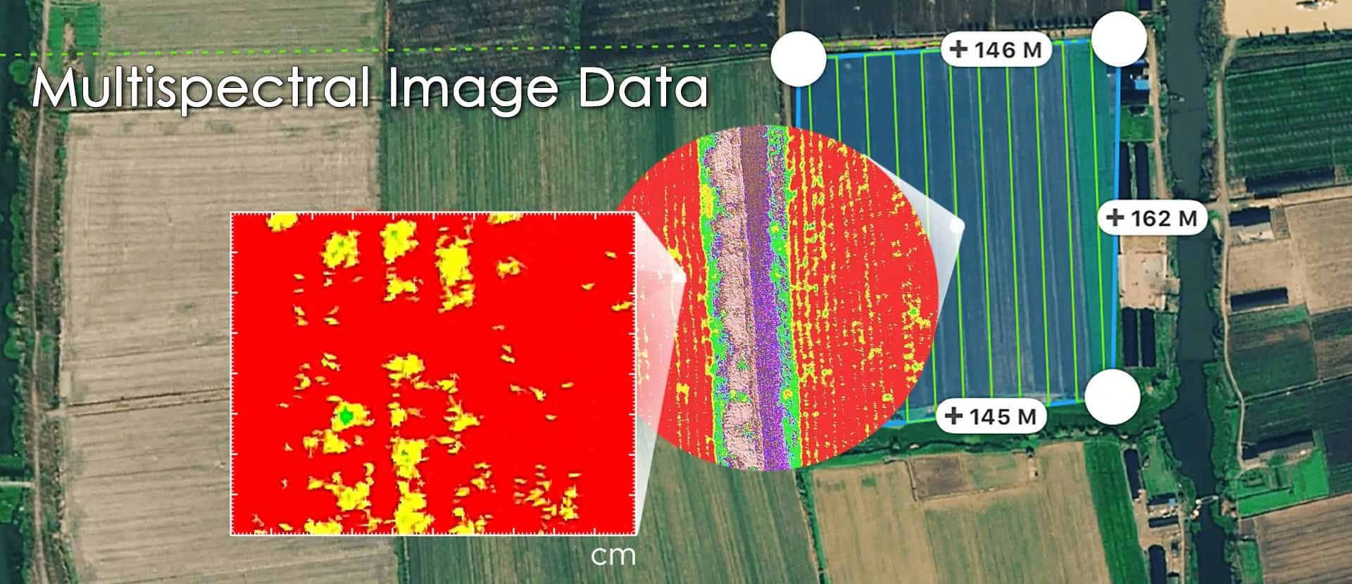
Efficient Crop Monitoring and Disease Detection
Drones have become indispensable tools for efficient crop monitoring and disease detection in agriculture. With their aerial capabilities, drones provide a comprehensive view of vast fields, enabling farmers to monitor crop health, identify stressed areas, and detect signs of diseases or infestations early on.
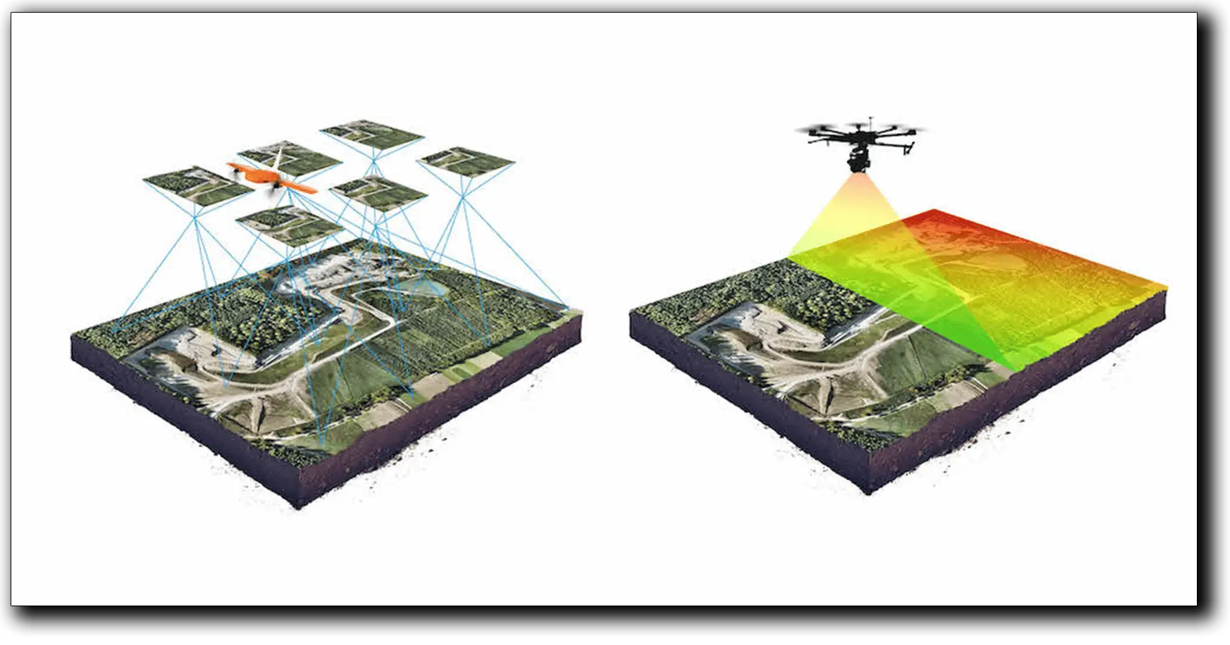
By capturing high-resolution imagery and employing advanced imaging technologies, drones can analyze plant health indicators such as chlorophyll levels, plant vigor, and nutrient deficiencies. This data empowers farmers to make data-driven decisions regarding irrigation, fertilization, and pest management, leading to optimized resource allocation and improved crop yield.
One of the key benefits of using drones in agriculture is their ability to survey large areas quickly and cost-effectively. Drones equipped with specialized sensors, such as multispectral or thermal cameras, can capture valuable data beyond the visible spectrum, providing insights into crop health that are not easily detectable to the naked eye.
With the top drone services in agriculture and crop monitoring, farmers gain a competitive edge by adopting precision agriculture techniques, reducing input costs, and maximizing crop productivity. Drones offer an efficient and accessible solution for sustainable farming practices, enabling farmers to make informed decisions and ensure the health and vitality of their crops.
The DJI Phantom 4 Multispectral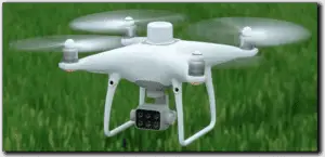
The DJI Phantom 4 Multispectral platform is a high-precision drone with a seamlessly integrated multispectral imaging system built for agriculture missions, environmental monitoring, and more.
- Sensor specifications – Six 1/2.9” CMOS, including one RGB sensor for visible light imaging and five monochrome sensors for multispectral imaging. Each Sensor: Effective pixels 2.08 MP (2.12 MP in total)
Other Agricultural Drone Services
 In addition to crop monitoring and disease detection, drones have expanded their role in agriculture to include other essential applications. By leveraging the data captured during multispectral scans, drones can facilitate precise fertilization, targeted insecticide application, and optimized irrigation. This data-driven approach allows farmers to implement precise and environmentally friendly practices, minimizing resource wastage and maximizing the overall efficiency of agricultural operations. Drones are revolutionizing the way farming is done, empowering farmers with actionable insights for enhanced productivity and sustainable practices.
Other Drone Services that have soared this year, is the demand for drones in infrastructure inspection tasks that are revolutionizing the way we assess and maintain various infrastructures. Drones offer a multitude of benefits for inspecting infrastructures, including bridges, pipelines, and power lines, to name a few.
Bridge Inspections
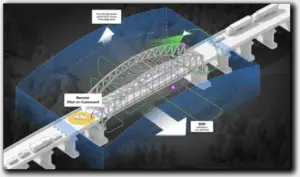 When it comes to bridge inspections, drones have become indispensable. They enable us to perform detailed 3D scans of structures, capturing accurate data for assessing their condition, identifying potential issues, and planning maintenance or repairs.
Power Line Inspections
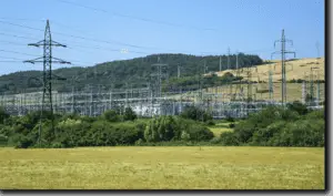 Drones play a vital role in power line inspections. With their high-resolution cameras, they provide valuable image data for detecting broken or corroded components, as well as monitoring vegetation encroachment or wire sagging. This enables us to proactively address maintenance needs and ensure the reliability and safety of power transmission.
Pipeline Inspections
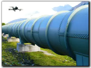
For pipeline inspections, drones offer a versatile solution. They can capture targeted image data of specific areas or even provide video footage for high-level visual inspection. This allows us to detect leaks, identify structural vulnerabilities, and assess the overall integrity of the pipelines more efficiently.
Drones equipped with photogrammetry and LiDAR sensors further enhance the inspection process by providing detailed 3D models and precise measurements for accurate analysis.
More of the drone services that have exploded this year are the wide range of inspection services as well as different types of photography opportunities. Drones are truly changing the landscapes for how we capture stunning visuals and perform various inspections.
Real Estate Photography
 Drones have long been a game-changer in the world of real estate photography. With their ability to capture a range of aerial shots, they provide potential buyers with a unique perspective of properties, showcasing their features and surroundings in a captivating manner. Drones help me create compelling visuals that attract attention and elevate the marketing efforts of real estate professionals.
Event Coverage
 When it comes to event coverage, drones bring a whole new level of excitement. Whether it’s a wedding, concert, or sporting event, drones can capture dynamic aerial footage that adds a sense of grandeur and immersion to the experience. I love using drones to capture those unforgettable moments from unique angles, making event coverage truly memorable.
General Inspections
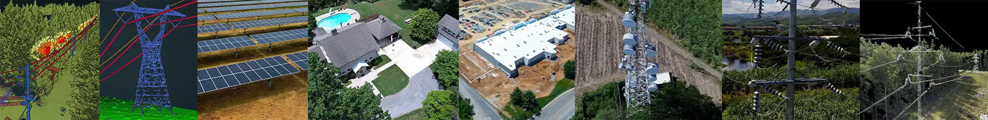 Drones have also become invaluable tools for conducting general inspections in various industries. Their versatility and maneuverability allow us to access hard-to-reach areas and inspect structures, equipment, or facilities with ease. Drones equipped with high-resolution cameras and specialized sensors provide detailed visual data, allowing us to detect issues, assess conditions, and ensure compliance with safety standards.
From roof inspections to infrastructure assessments, drones offer a cost-effective and efficient solution for general inspections in sectors like construction, insurance, and infrastructure management.
Incorporating drone services into inspection and photography not only expands the possibilities but also delivers captivating visuals, enhanced efficiency, and improved safety across different industries.
 Click into this article “Can I Make Money with my DJI Air 2S?” to see how the DJI Air 2S can be used for Real Estate, Event and General Inspection services.